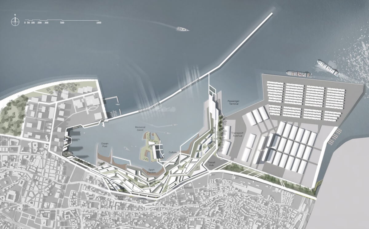
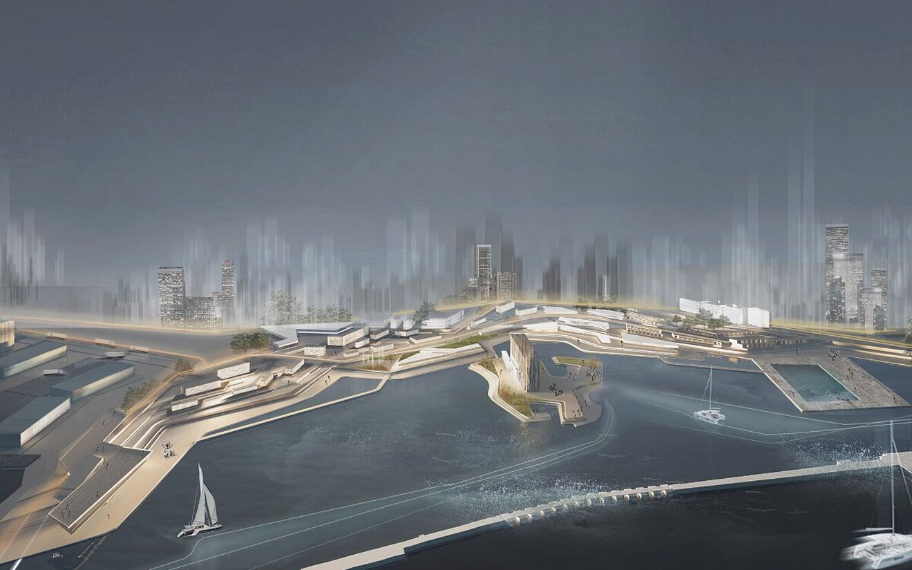
TOPOHOOD is a redevelopment project of the Port of Beirut, which was destroyed by an explosion in 2020. The proposal creates a neighborhood area connected with topography that addresses rising sea levels. It also provides three main functions – industrial harbor, mixed-use neighborhood, and Memorial Island – tied together with the culture and lifestyle of Beirut citizens. The project was part of the Masters Studio 1 and 2 at Tsinghua University 清华大学建筑系, as well as part of competition entry made by Giselle Low Zi Ning and Lukáš Šomodi.
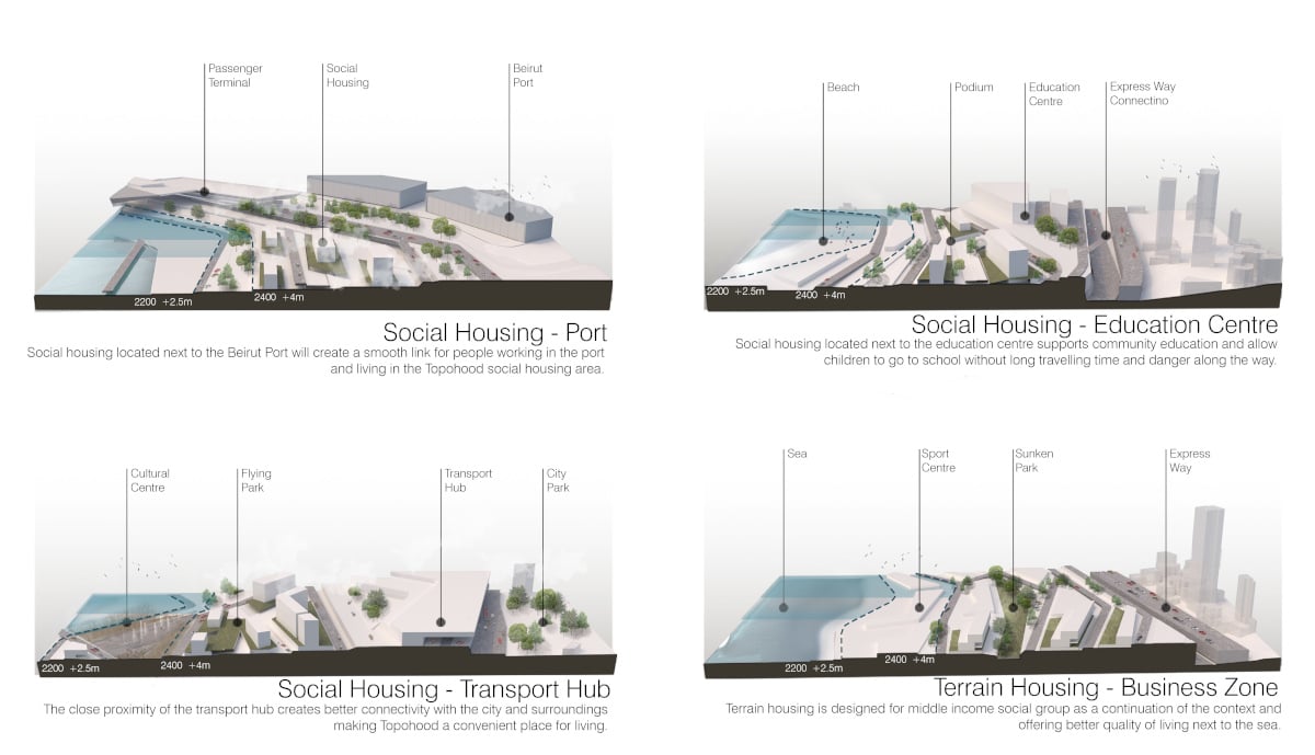
Rising sea levels are an ongoing issue that is estimated to cause massive damage in major coastline cities all over the world. Sea levels are predicted to increase by 0.6 to 1.1m (1 to 3 feet) by the year 2100, followed by 4 meters by 2400. To respond to this issue and protect Beirut city, the proposal uses on-site resources to reshape the port topography in a strategic manner. This creates a long-spanning flood protection barrier while creating platforms with mixed programs focused on community and social lifestyle. This will help enhance the economic growth of the newly proposed industrial port.
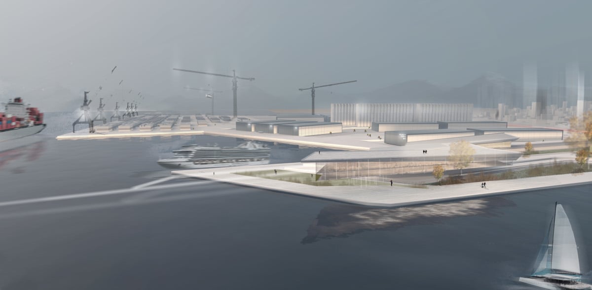
The new industrial harbor is located on the eastern part of the site, spanning from the container terminal to the expressway. It is proposed as a continuation of the existing Port of Beirut while offering rentable spaces which will boost further development of the city, industry, and economy. The buffer between the public coastline and the industrial harbor is created by the telescopic harbor bridge that forms two bays. The bridge functions as a pedestrian connection linked with breakwater as well as the boundary for large ships to enter the public coastline, which is part of the mixed-use residential zone.
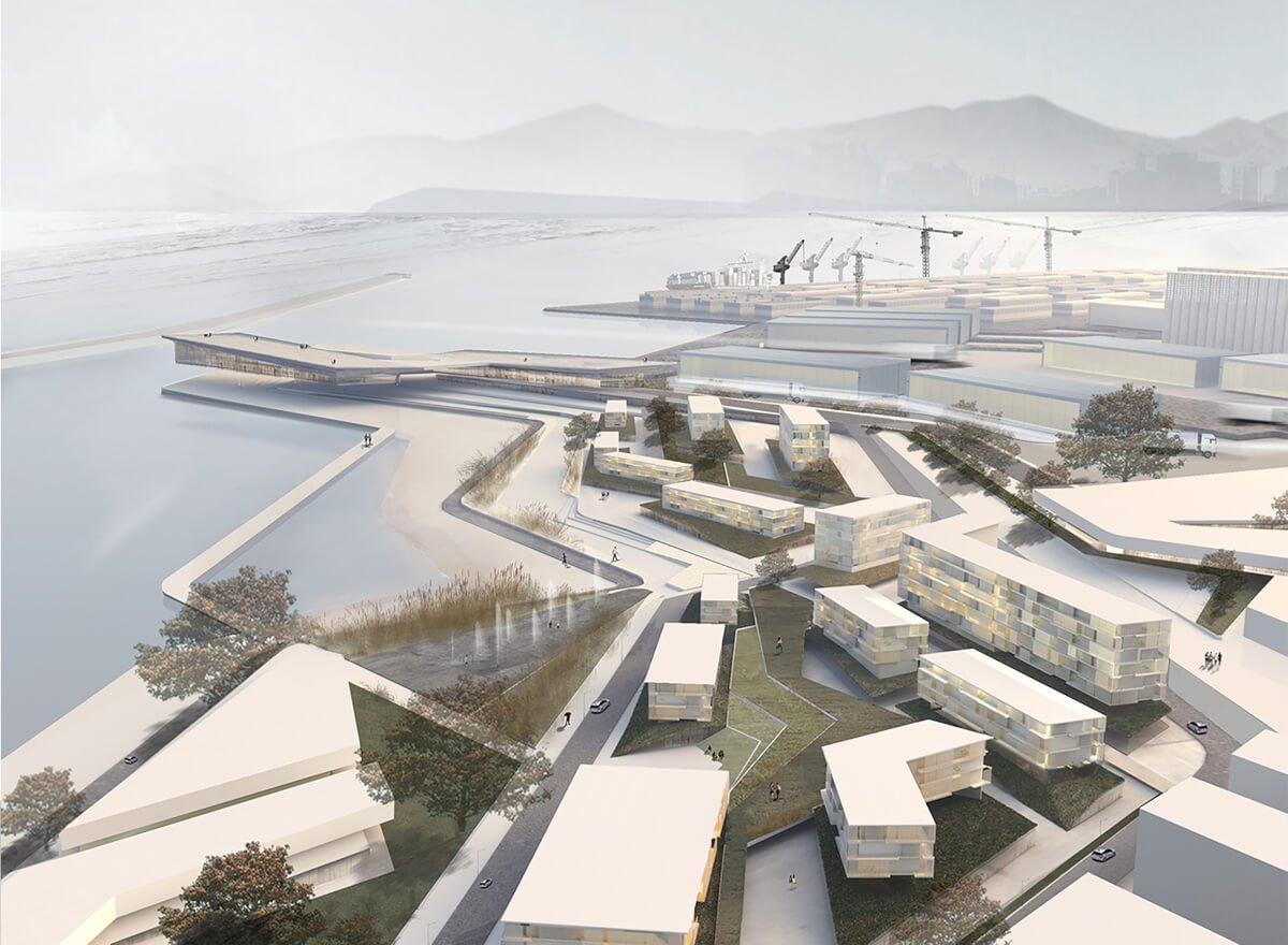
Our proposal offers more land for social and economic growth in the central and western part of the site. This not only blends with the city context, it also offers over 2,800m of public coastline back to local citizens. The destroyed residential clusters within an existing industrial zone would be moved to more feasible space on the central and western part of the site, offering better living and working conditions for both physical and mental health.
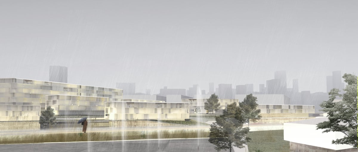
The residential area is surrounded by various programs supporting social, cultural, active, educational, and business life. The diversity of these amenities is connected to the surrounding context while adding the missing functions that citizens and visitors would need. The topography blended with the program creates public spaces that form different activities focusing on a more community-like environment, while offering stunning views towards the sea.
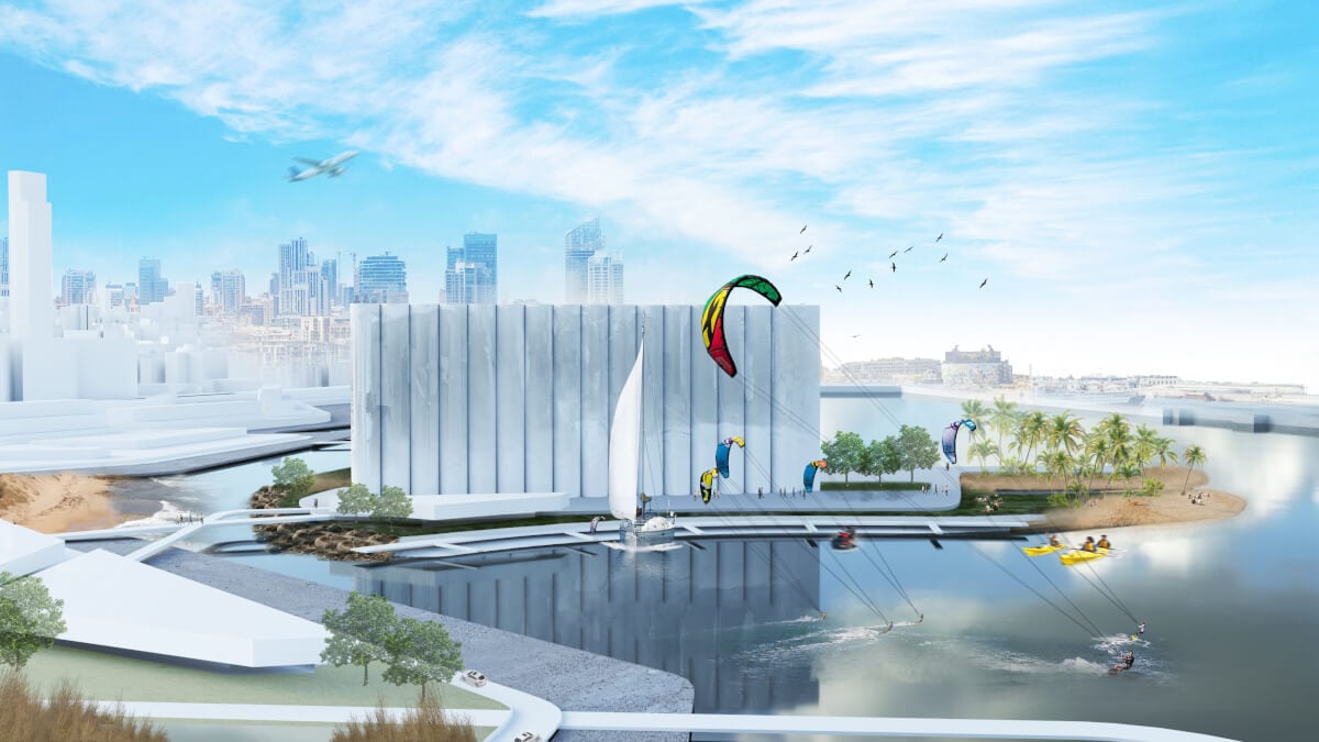
The highlight of TOPOHOOD is Memorial Island, located in the heart of the public zone. Memorial island is a special place that brings all the people together without any racial, social, and religious differences – just as it did right after the blast, when people wanted to help each other by forming a strong and bonded society. The island uses natural power of water that would shape the coastline over time, creating an iconic space to commemorate, reflect, and connect with loved ones.
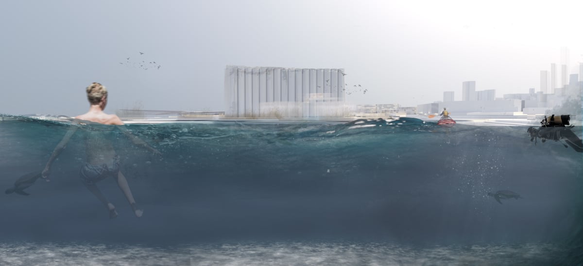
This project was based on a collaboration between two software platforms, ALLPLAN and Rhino. The ability to import a Rhino file into ALLPLAN and vice versa made the whole collaborative project much more efficient, enabling independent work to be easily merged at the end. An efficient render in ALLPLAN allowed us to quickly create images capturing the atmosphere of the space that were suitable for tutorials discussing the spatial design from the human eye’s point of view.
